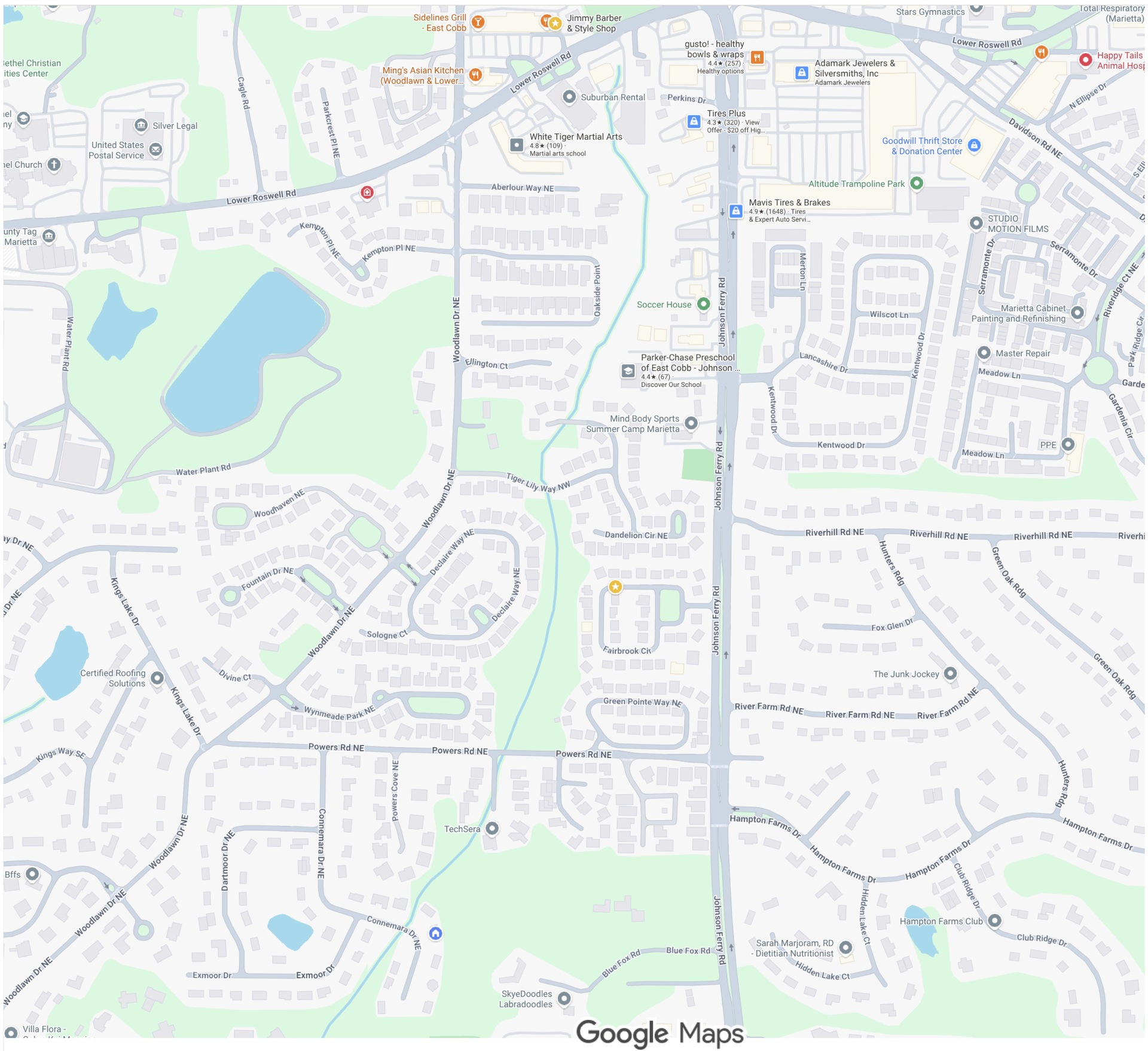
232 Connemara Drive borders a creek, and 230 Connemara Drive borders 232 Connemara Drive. Both properties flood frequently after newer housing developments were built upstream, as explained and documented below.
Click on any image to load a full-size version, then click your browser's "back" button to return to this page.
You can contact me at chris.simpkins@gmail.com.
The main conclusion is this:
The flooding that now occurs frequently is not a natural occurrence. It is man-made!
A stream originates from an underground spring near the intersection of Lower Roswell Road and Johnson Ferry Road and flows south-southwest past Powers Place and Connemara Drive. The houses on Connemara Drive were built in the 1980s. All of the other houses south and north of Powers Road were built a decade or more later.
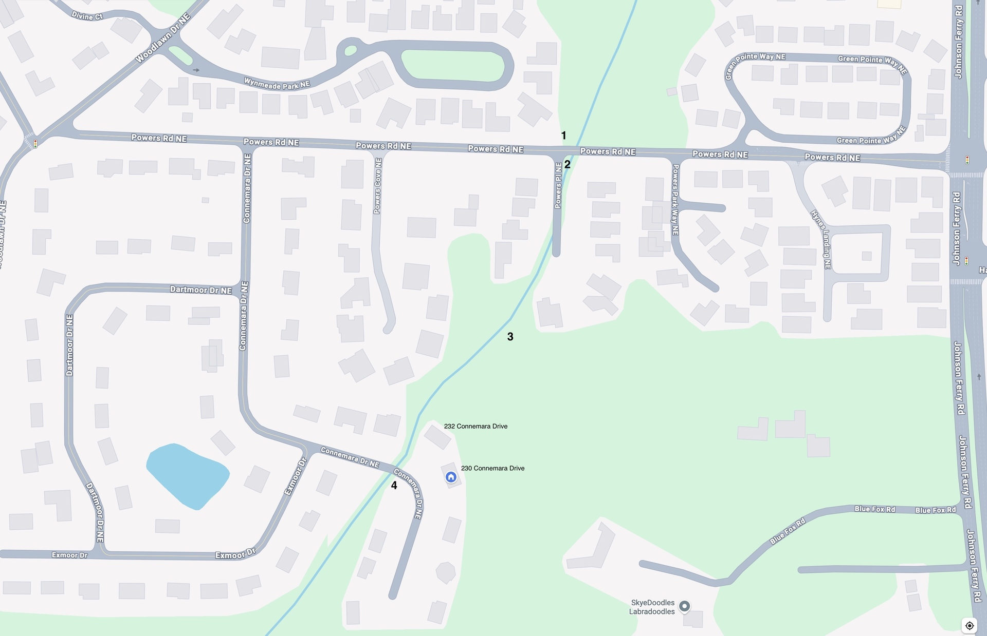
1. Powers Road looking down Powers Place
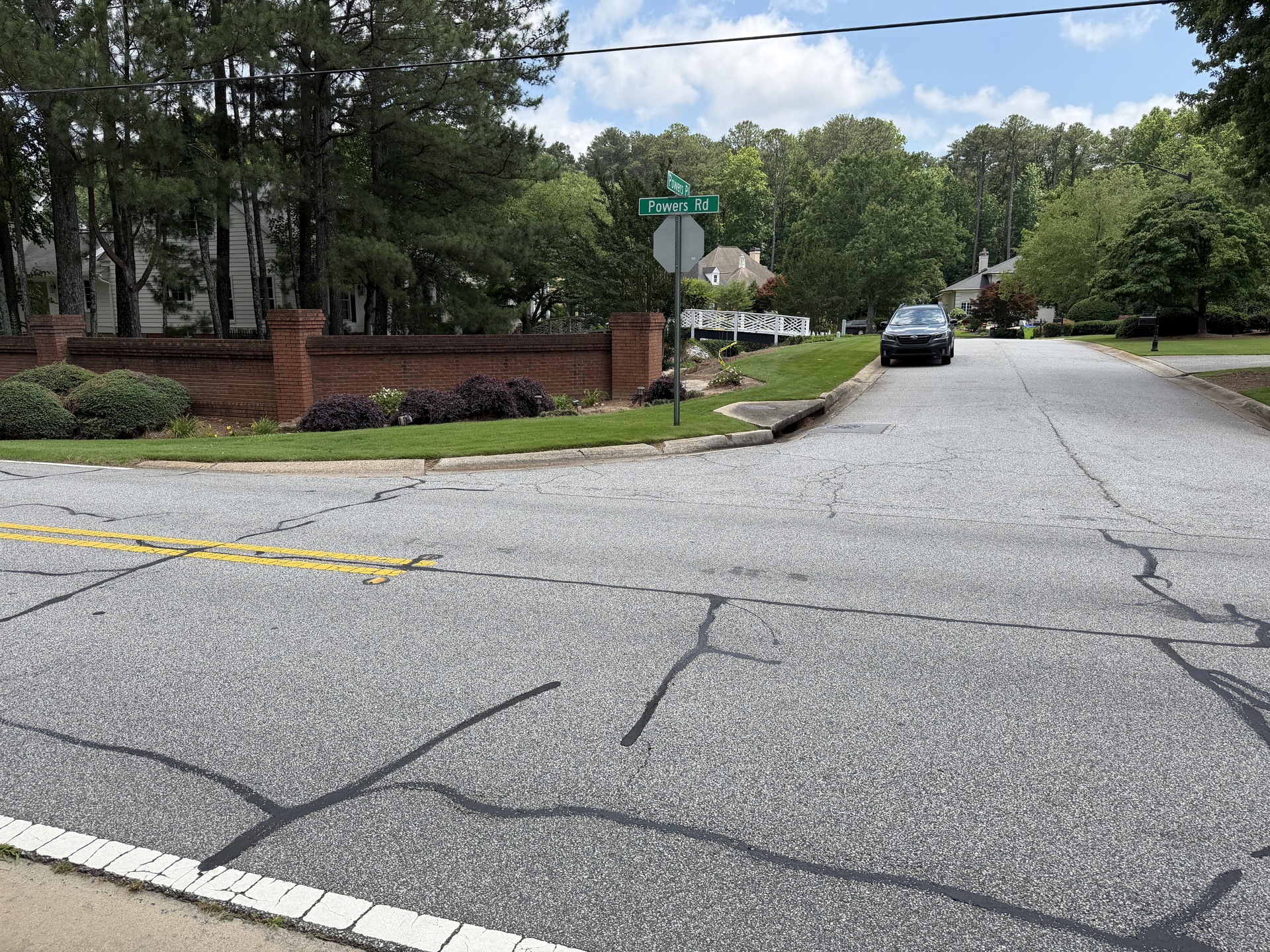
The entrance to Powers Place is located at a valley in Powers Road. So all of the storm water from Powers Road dumps into Powers Place. |
2. Creek directing stream past Powers Place
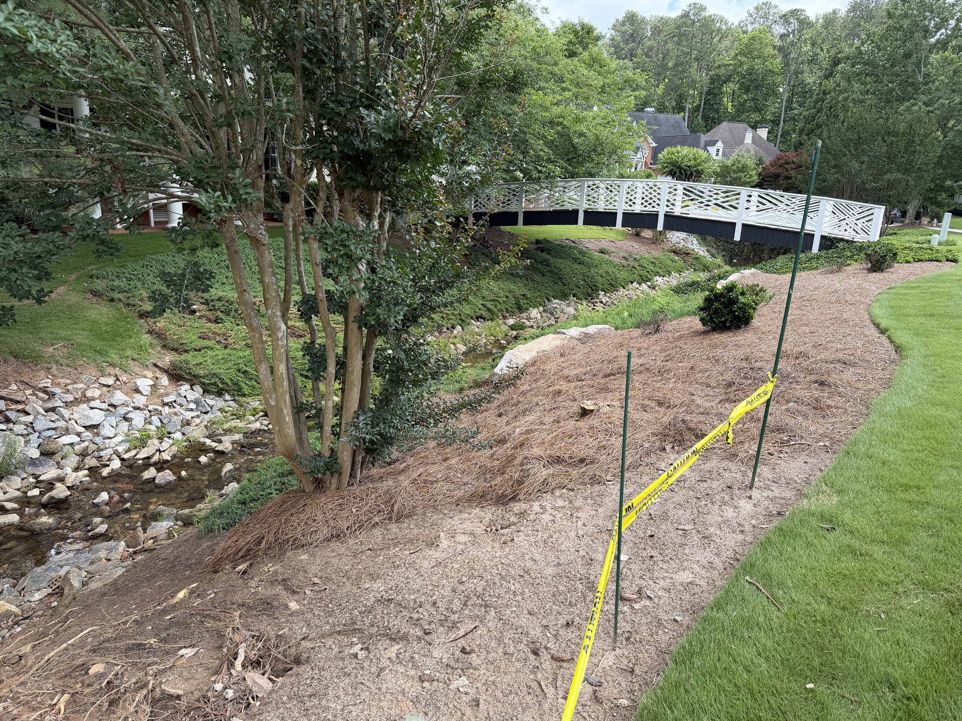
A deep creek directs the stream past Powers Place and under the cul-de-sac. |
3. Runoff into creek just south of Powers Place
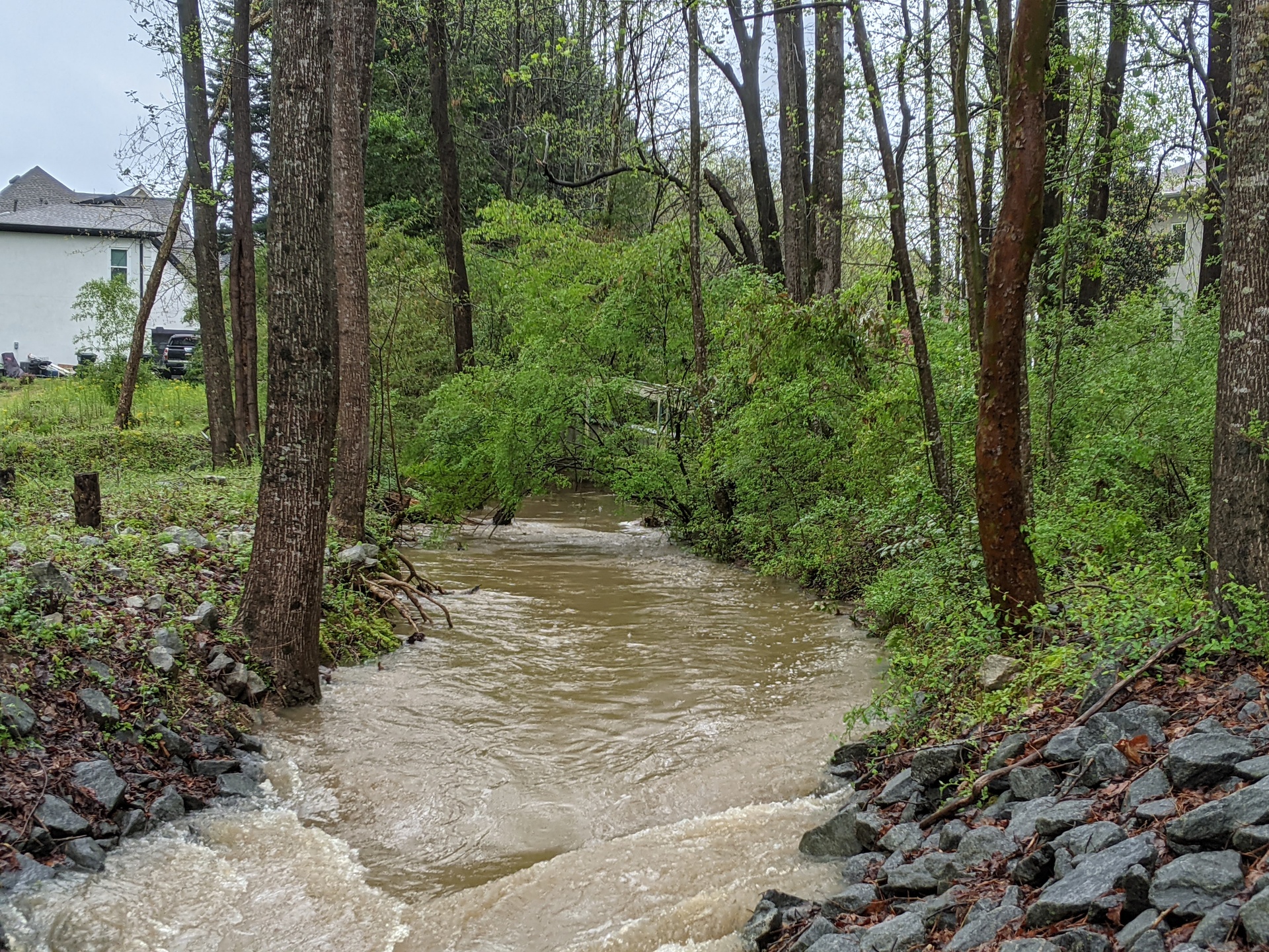
The creek south of Powers Place facing north. Powers Place and the surrounding houses add their runoff, and all of this extra water is dumped into the creek. This picture was taken on a day of mild rain. |
4. Culvert under Connemara Drive
This video starts on the downstream (south) side of the Connemara Drive culvert, then moves to the upstream (north) side. The creek on the upstream (north) side of Connemara Drive is far shallower than on the downstream (south) side, and the double-pipe-and-concrete design of the culvert turns into a dam in heavier rains, as seen below. |
In acute rain conditions, all of this extra runoff overwhelms the culvert running under Connemara Drive, which was designed for the development conditions that existed in the 1980s.
Long-time residents on Connemara Drive report that flooding only started occurring after the newer developments were built upstream. In addition to Powers Place, several other subdivisions north of Powers Road were built on the east and west banks of the stream. All of this development has overwhelmed the water-handling infrastructure downstream that was built a decade or more before these new developments were built.
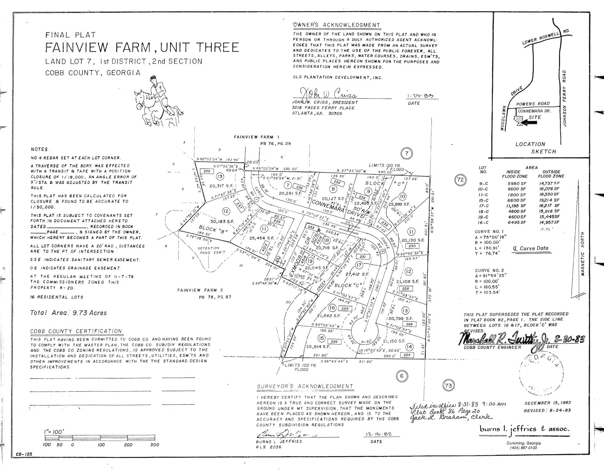
In the plat above, notice that the original limits of the 100-year flood zone do not reach the houses at 232 (Lot 10) and 230 Connemara Drive (Lot 11) (the depiction of locations of the houses in the plat are inaccurate). In fact, the flood zone only reaches a corner of Lot 11, 230 Connemara Drive -- 91% of Lot 11 is outside the flood zone. And yet, as the picture below document, 230 Connemara Drive has experienced four flooding events in the last 5 years and 7 months -- two of them severe. The main conclusion bears repeating:
The flooding that now occurs frequently is not a natural occurrence. It is man-made!
The financial losses pale in comparison to the trauma of helplessly watching flood waters rise and invade your home.
Note: dates are expressed in ISO 8601 format, YYYY-MM-DD.
On October 10, 2020 we experienced our first flood since buying the home in 2019. This severe flood caused approximately $55,000 in damage.
The video above starts with the downstream (south) side of Connemara Drive, showing the outflow from the culvert and the ample remaining capacity of the creek. It then moves to the upstream (north) side of Connemara Drive, showing how the double-pipe-and-concrete culvert turns into a dam, causing water to overflow into the yards and houses of 232 and 230 Connemara Drive.
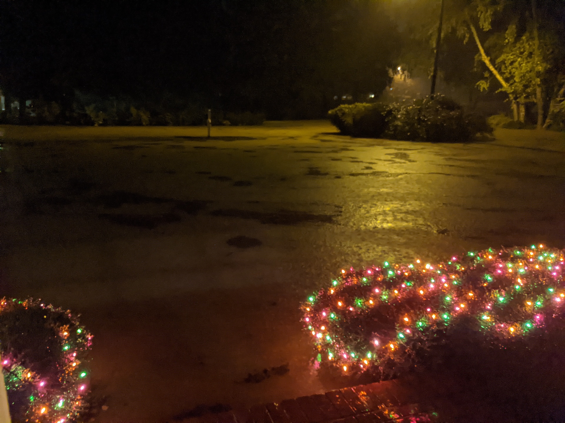 The view from the front porch.
|
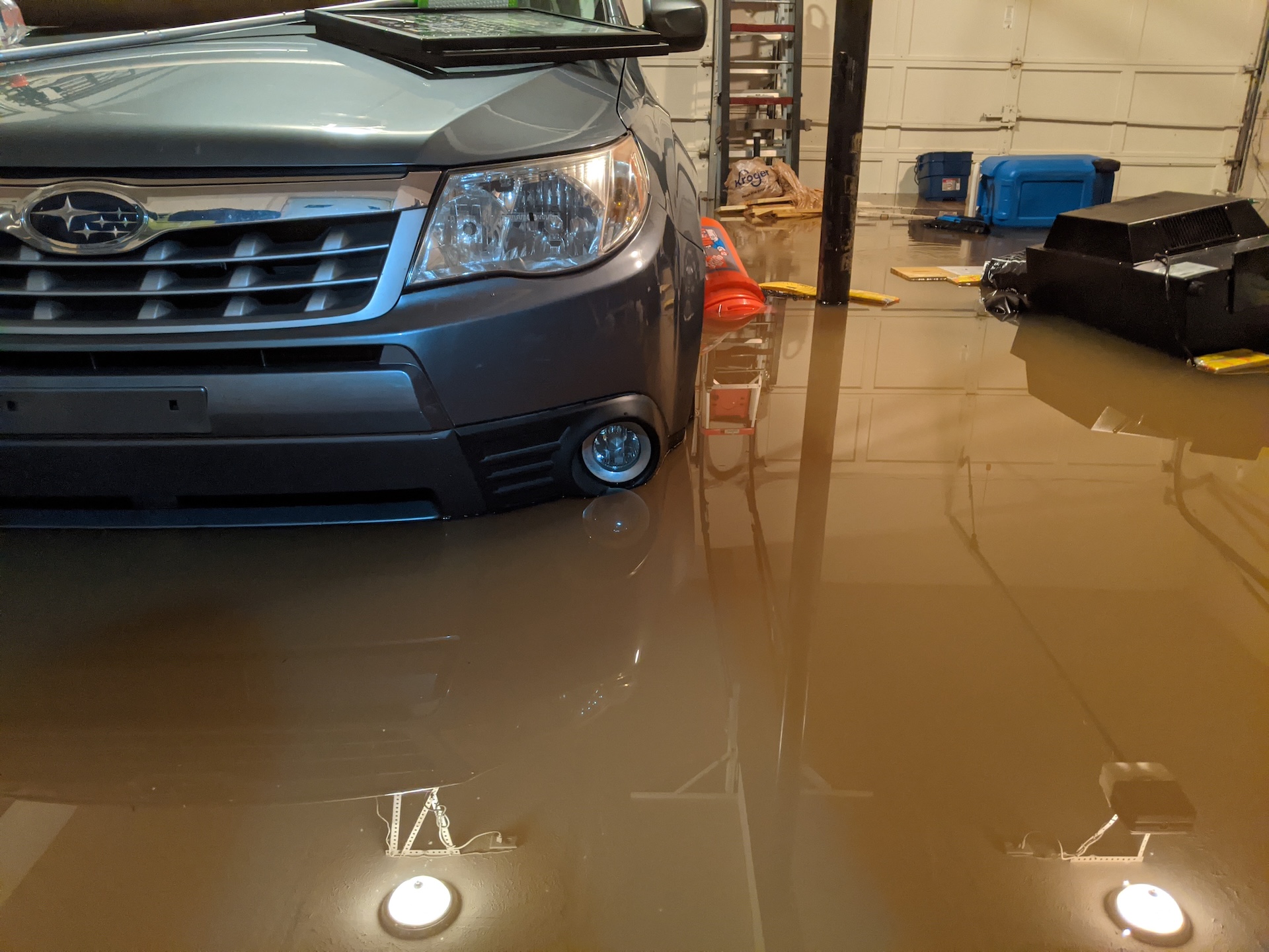
Flood water reached 15 inches in the garage, totaling both cars (the other car was in the driveway). |
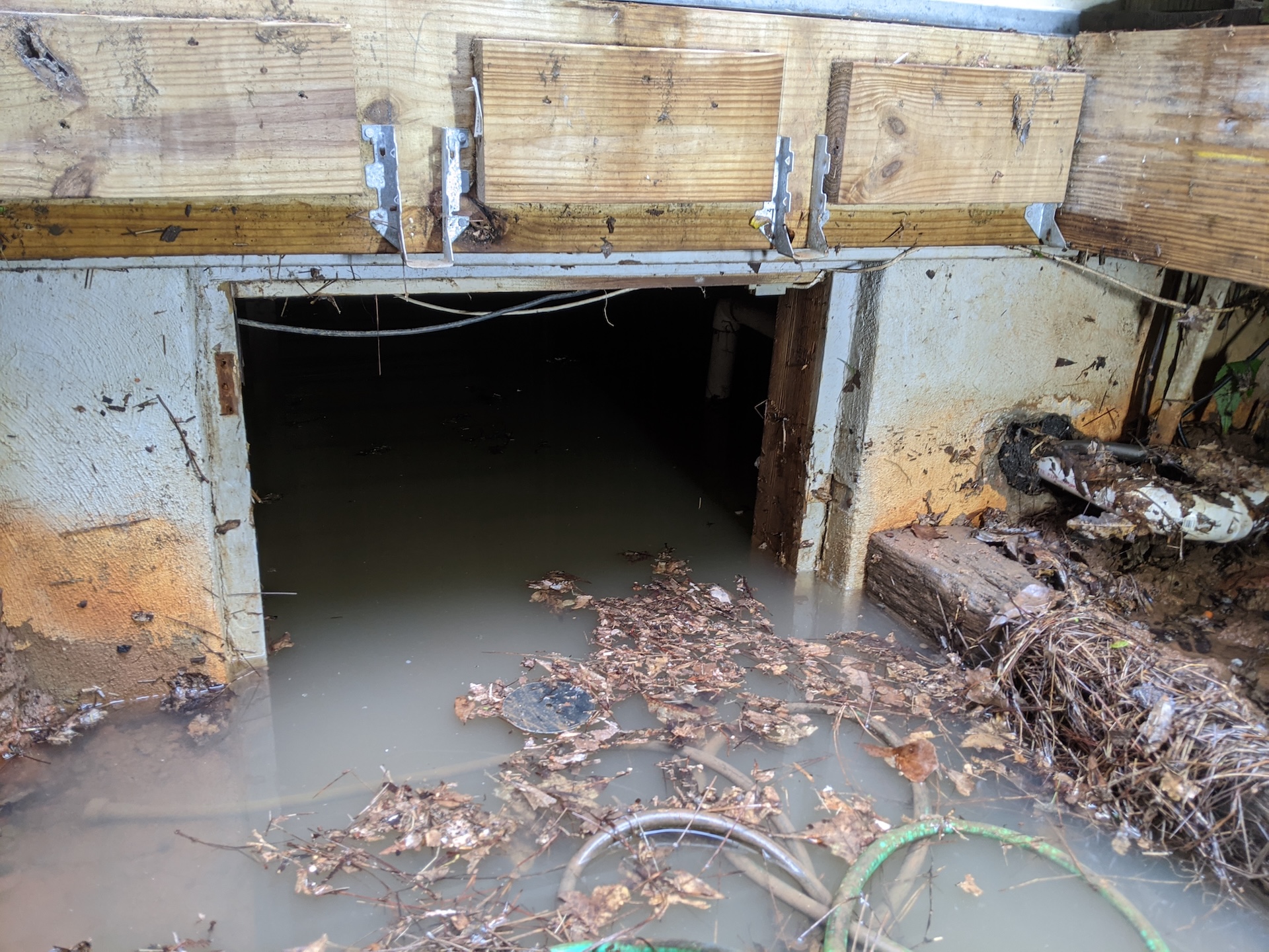
Flood water in the crawl space destroyed a year-old HVAC system and ducts. |
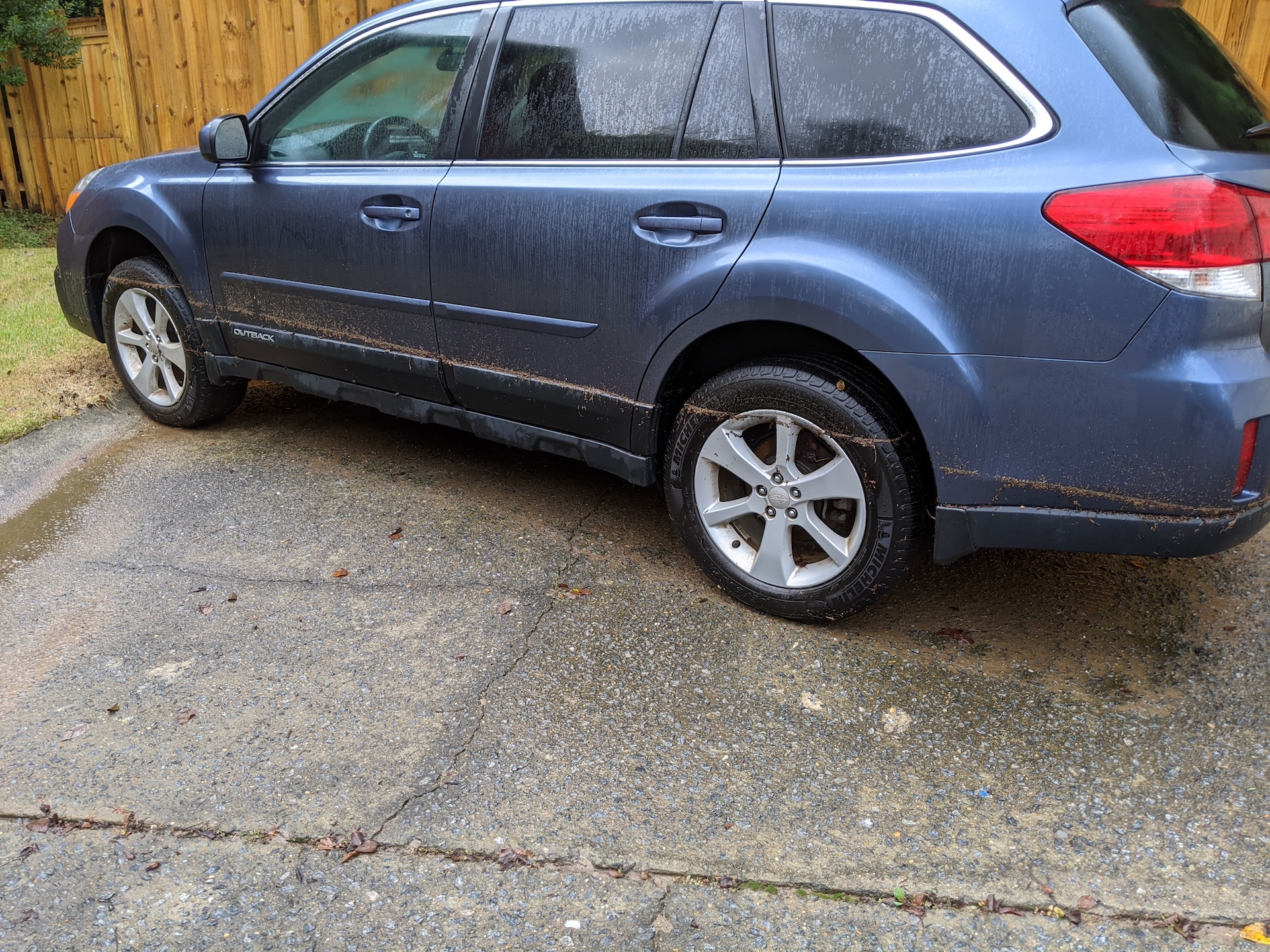
The flood water line on one of our cars the day after the flood. If flood water reaches the floorboard of a car, the car is a total loss due to the impossible-to-repair electronics running along the floorboard. |
This video shows the upstream (north) side of Connemara Drive, showing how the double-pipe-and-concrete culvert turns into a dam. Then the camera pans across the yards of 232 and 230 Connemara Drive, showing how the flood waters overflow from the dammed-up creek into our yards and homes.
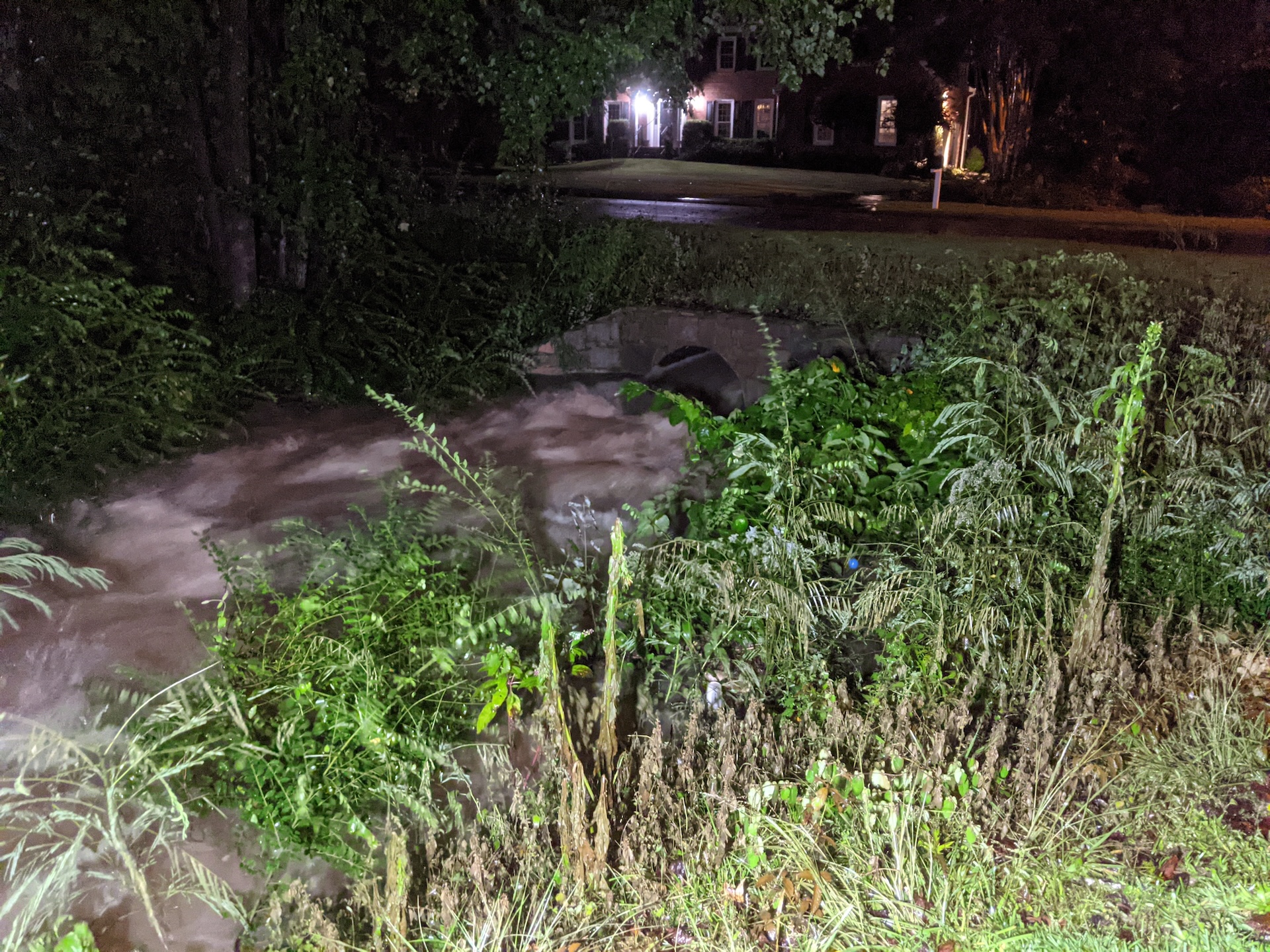
The downstream (south) side of the culvert, showing its plentiful additional capacity to absorb the extra water. This also shows how the culvert actually accelerates the water on the downstream side, causing additional erosion. |
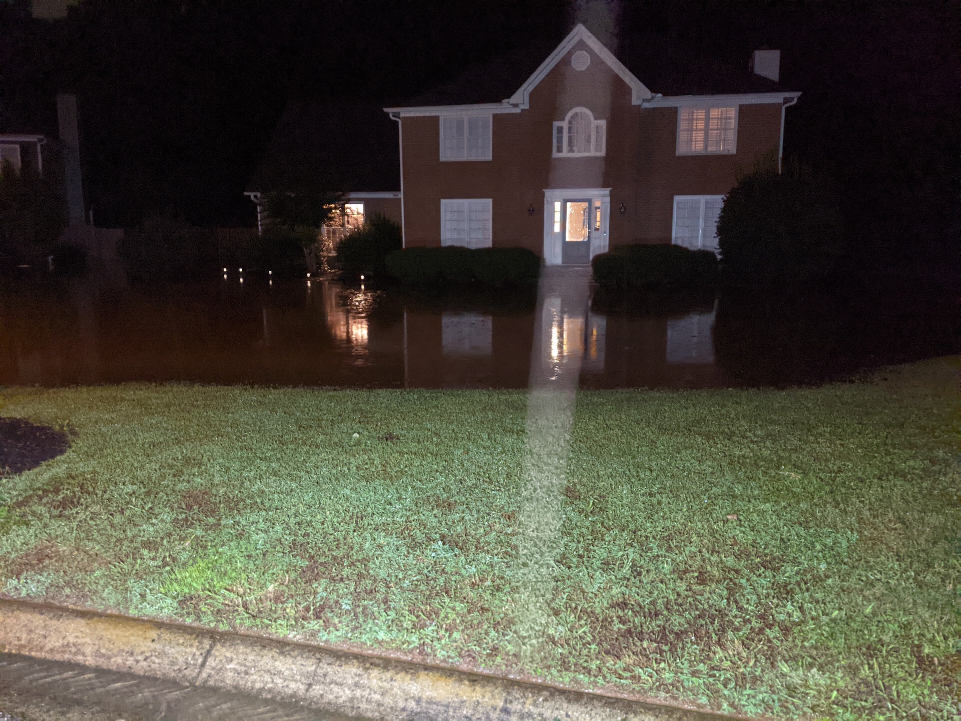
The extent of the flood waters. This was only a major flood. In severe floods the water covers the road up to the edge of 230 Connemara Drive. In severe floods the depth of the water at the low point of the driveway is approximately three feet. |
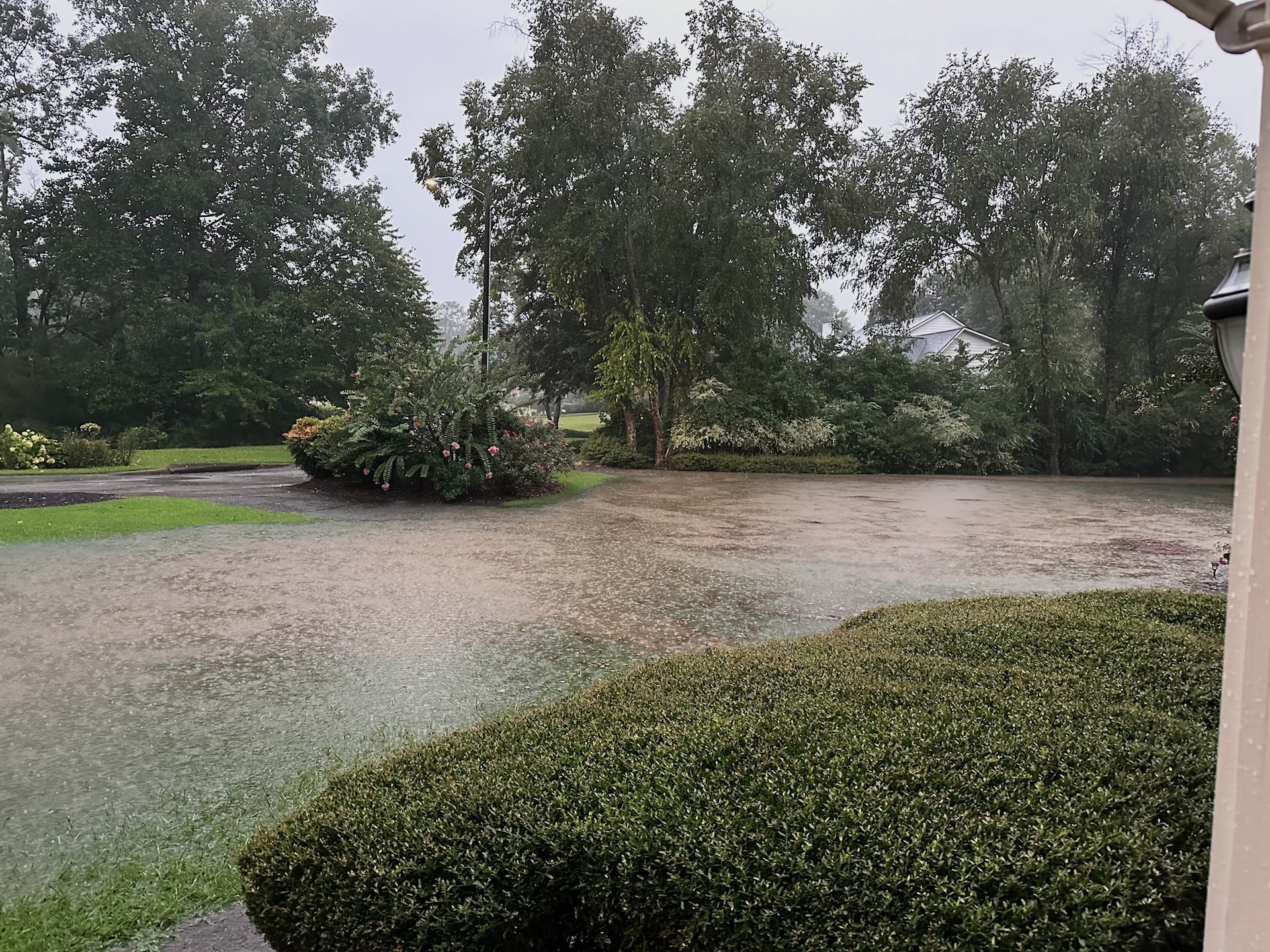
The driveway is about a foot lower than the garage. So when the flood waters rise, it's often too late to move the cars by the time we notice. |
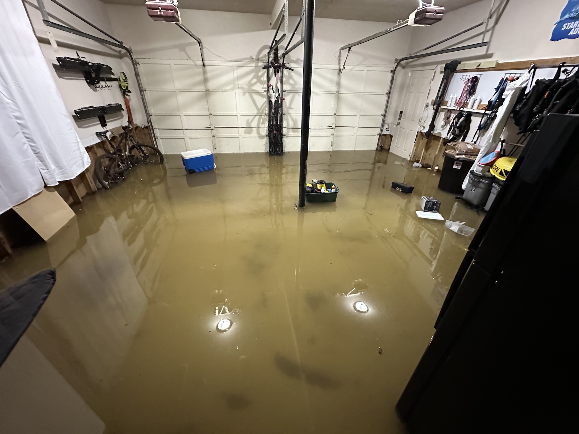
The garage floods frequently. Luckily we had already moved the cars to higher ground before the flood waters made our driveway impassable. |
A heavy rain, not associated with a hurricane or other major weather event, led to severe flooding which caused approximately $16,000 in covered losses. That figure would be much higher if not for FEMA's restrictions. We also took several steps to make the house resilient to floods, like elevating structures and removing mechanical systems from the crawl space (we did have a dehumidifier that was not covered).
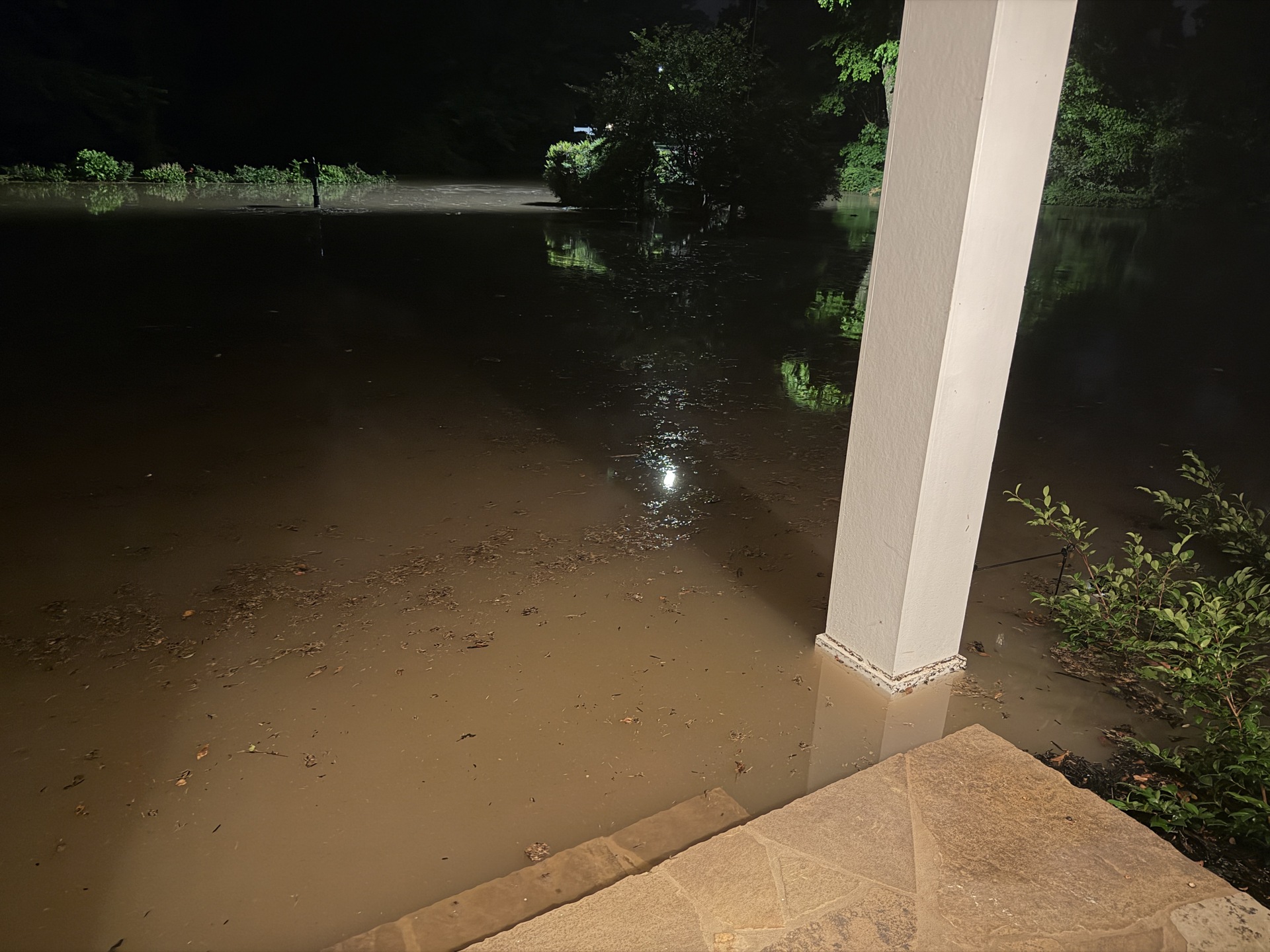
View from front porch. Flood waters cover full lots of 230 and 232 Connemara Drive, and Connemara Drive itself. |
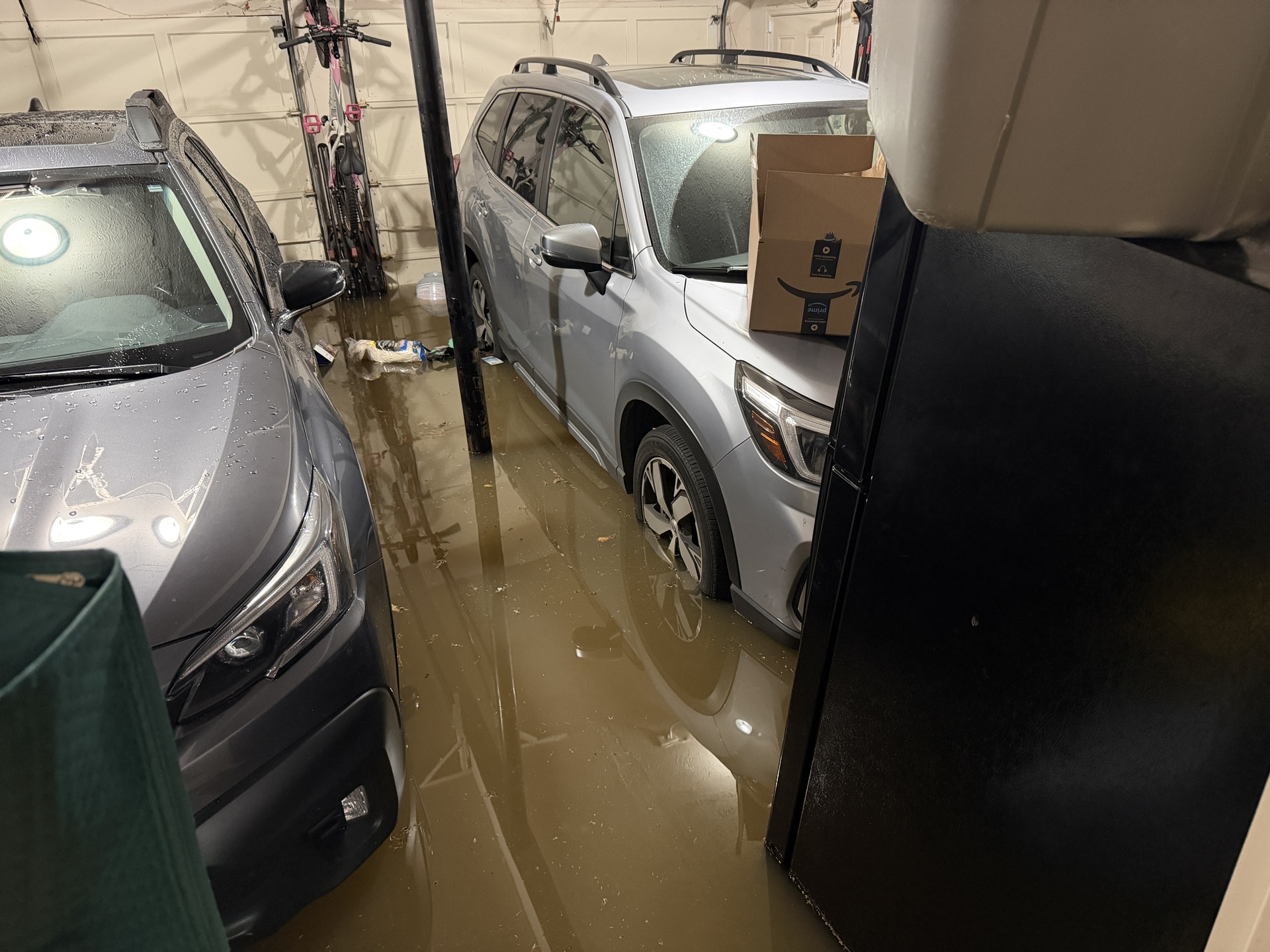
Garage flooding. The cars are on 7 inch-high ramps. See below. |
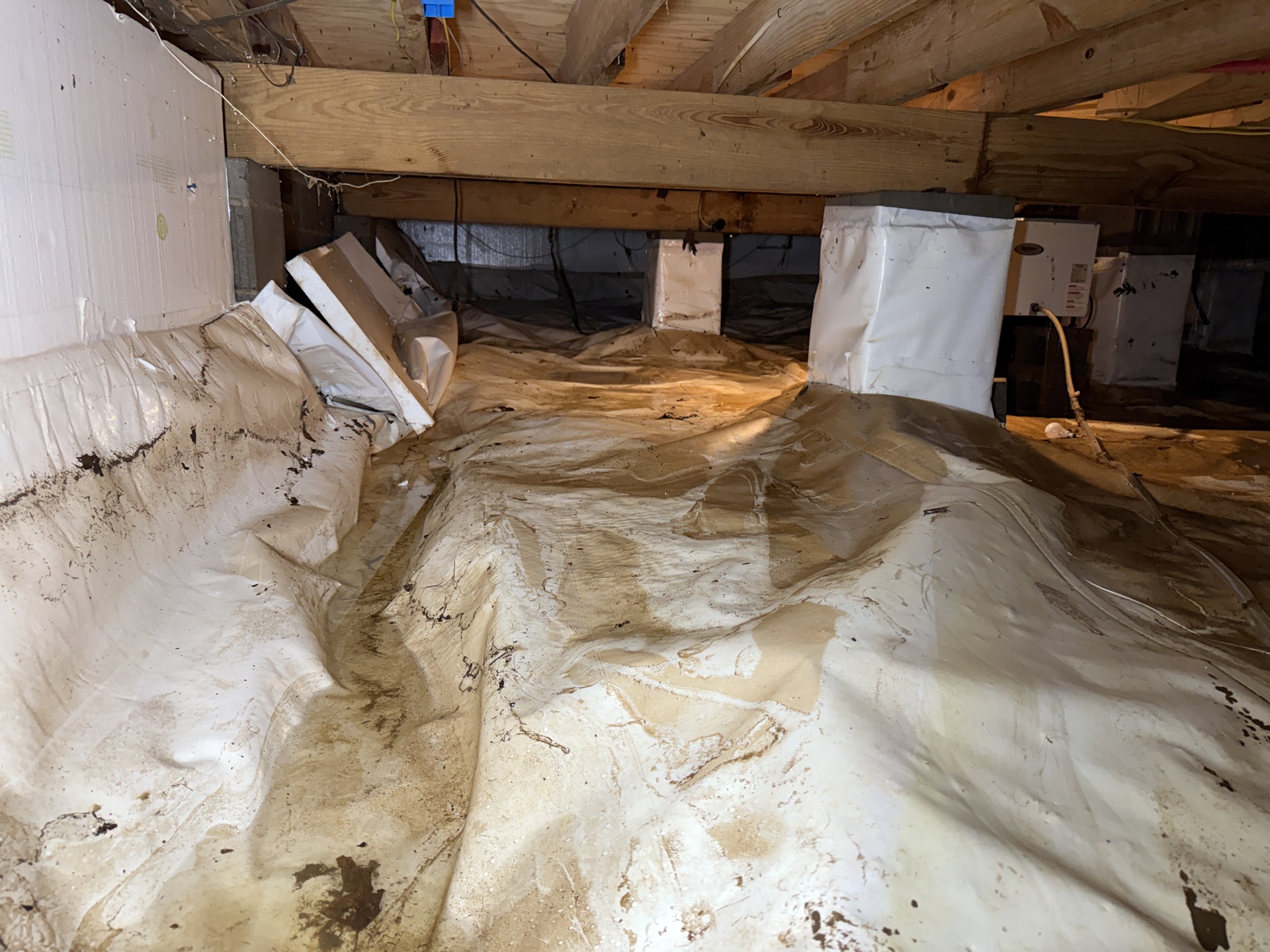
The flood waters entered the crawl space up to the floor joists, destroying a $1,700 dehumidifier and damaging foundation wall insulation and vapor barrier. |
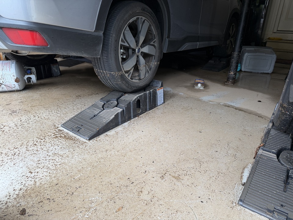
The cars on ramps the following day showing the flood line from the 16-inch flood depth in the garage. |

Even though we had the shed elevated on cinder blocks, the flood waters were still too high. FEMA does not cover anything outside the house. |
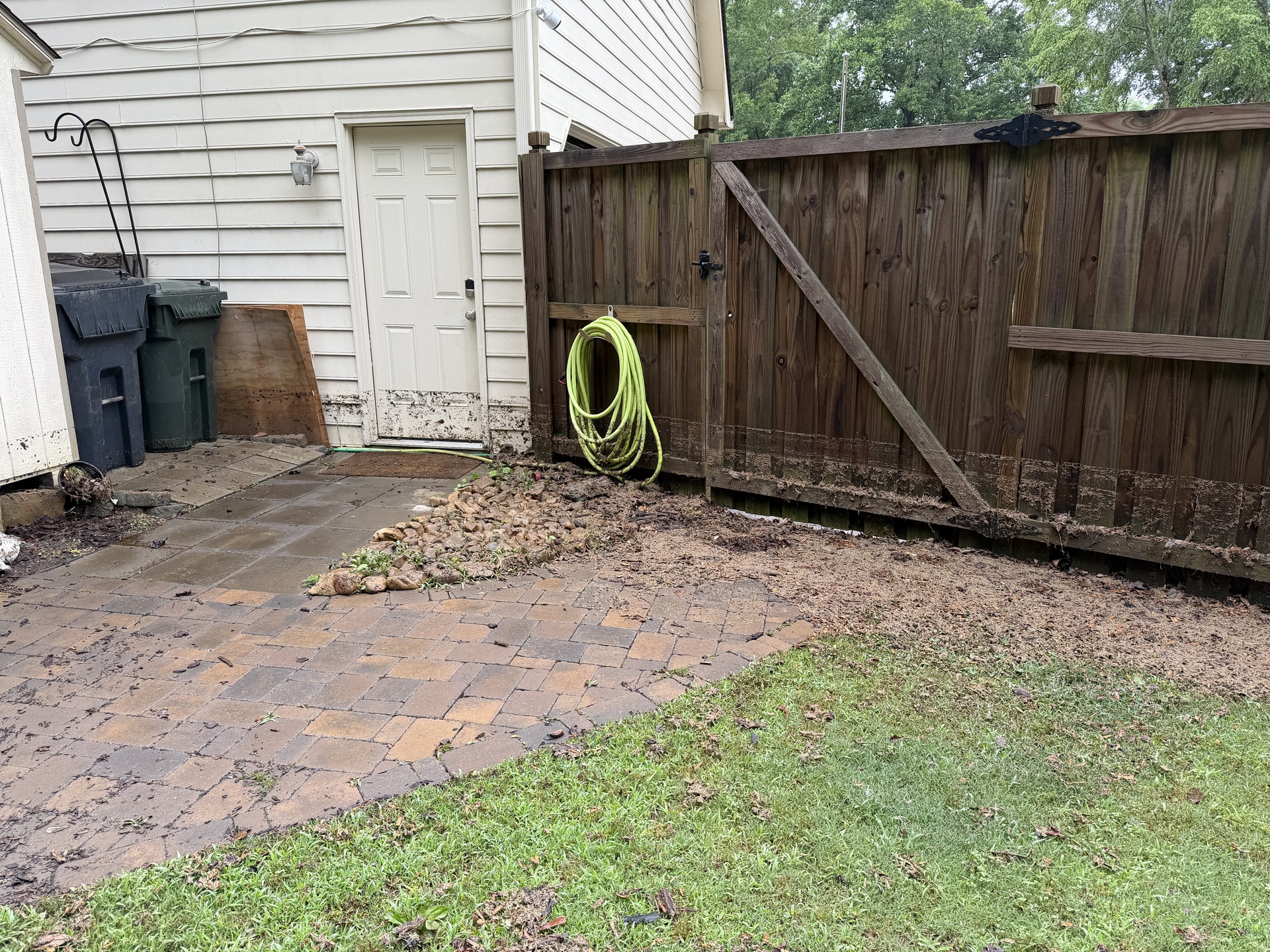
The flood line on the fence and the door to the garage. We even built an elevated platform for the trash cans, but the flood waters were higher in this flood than in any previous flood. |